
The Crowsnest Highway represents one of Canada’s most spectacular and historically significant transportation corridors, stretching 1,161 kilometers from Hope, British Columbia to Medicine Hat, Alberta. This comprehensive guide provides essential information for accessing and navigating this remarkable route, complete with detailed driving distances, elevation profiles, and practical travel information for both recreational travelers and commercial transport operators.
Overview of Crowsnest Highway 3
The Crowsnest Highway, officially designated as Highway 3 throughout its length, serves as the southernmost highway route through the Canadian Rockies and provides the shortest connection between British Columbia’s Lower Mainland and southeastern Alberta. Originally designated in 1932, the highway follows a mid-19th-century gold rush trail traced by engineer Edgar Dewdney, taking its name from the Crowsnest Pass where it crosses the Continental Divide. The route encompasses diverse landscapes from coastal rainforests and desert valleys to towering mountain peaks, offering travelers an alternative to the busier Trans-Canada Highway while providing access to numerous recreational opportunities and historic communities.
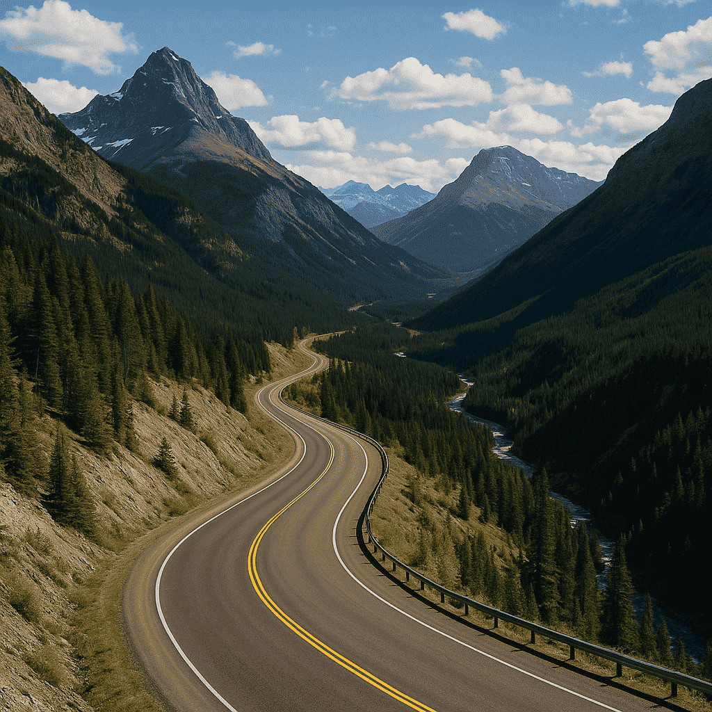
Scenic view of Crowsnest Highway through the Canadian Rockies
The highway begins at Hope, British Columbia, where it branches eastward from the Trans-Canada Highway, and traverses five major mountain passes before reaching the Alberta border at Crowsnest Pass. In British Columbia, the 841-kilometer western section is characterized by mountainous terrain and includes notable segments such as the Hope-Princeton Highway and passes through Manning Provincial Park. The Alberta portion extends 324 kilometers from the provincial border through rolling foothills and prairie landscapes to its eastern terminus at the Trans-Canada Highway in Medicine Hat.
Primary Access Routes and Starting Points
Western Access from British Columbia
Travelers approaching from Vancouver and the Lower Mainland typically follow the Trans-Canada Highway (Highway 1) eastward through the Fraser Valley to Hope, where Highway 3 begins its journey toward the Rockies. The distance from Vancouver to Hope is approximately 150 kilometers, requiring about 1.5 hours of driving time under normal conditions. Alternative routes include Highway 7 (Lougheed Highway) through Coquitlam and Mission, which provides a more scenic but slower approach to the Fraser Valley.
From Victoria and Vancouver Island, travelers must use BC Ferries services to reach the mainland before connecting to Highway 3 via the Trans-Canada Highway. The total distance from Victoria to Hope is approximately 247 kilometers, including ferry travel time. Northern British Columbia residents can access Highway 3 through Kamloops via Highway 5 (Coquihalla) or Highway 1, with Kamloops being 288 kilometers from Hope.
Eastern Access from Alberta
Calgary serves as the primary eastern gateway to Crowsnest Highway, located approximately 186 kilometers from Crowsnest Pass via Highway 22 and Highway 3. The driving time from Calgary to the pass is typically three hours under favorable conditions. From Edmonton, travelers can access the route by driving south on Highway 2 to Calgary, then continuing west on Highway 3, for a total distance of approximately 481 kilometers to Crowsnest Pass.
Lethbridge provides another important access point, situated 164 kilometers from Fort Macleod and serving as a major commercial and transportation hub along the southern Alberta corridor. The city’s location makes it an ideal staging point for travelers continuing west toward the mountain passes or east toward Medicine Hat and Saskatchewan.
Comprehensive Driving Distance Tables
Table 1: Distances from Vancouver to Major Highway 3 Destinations
| Destination | Distance (km) | Distance (miles) | Driving Time (hours) |
|---|---|---|---|
| Hope | 150 | 93 | 1.5 |
| Manning Park | 194 | 121 | 2.5 |
| Princeton | 267 | 166 | 3.5 |
| Keremeos | 339 | 211 | 4.0 |
| Osoyoos | 399 | 248 | 4.5 |
| Grand Forks | 520 | 323 | 5.5 |
| Castlegar | 567 | 352 | 6.0 |
| Creston | 612 | 380 | 6.5 |
| Cranbrook | 693 | 431 | 7.5 |
| Fernie | 778 | 483 | 8.5 |
| Calgary | 672 | 417 | 7.0 |
This table demonstrates the progressive distances from British Columbia’s largest metropolitan area to key destinations along the Crowsnest corridor. The driving times reflect normal summer conditions and may increase significantly during winter weather or construction periods.
Table 2: Distances from Calgary to Western Destinations
| Destination | Distance (km) | Distance (miles) | Driving Time (hours) |
|---|---|---|---|
| Lethbridge | 214 | 133 | 2.3 |
| Fort Macleod | 164 | 102 | 1.8 |
| Pincher Creek | 116 | 72 | 1.3 |
| Crowsnest Pass | 186 | 116 | 2.0 |
| Fernie | 240 | 149 | 2.5 |
| Cranbrook | 321 | 199 | 3.5 |
| Creston | 366 | 227 | 4.0 |
| Castlegar | 413 | 257 | 4.5 |
| Grand Forks | 534 | 332 | 5.5 |
| Osoyoos | 727 | 452 | 7.5 |
Calgary’s position as Alberta’s largest city makes it a crucial reference point for travelers heading west along Highway 3. The distances shown reflect the most direct routes and assume favorable driving conditions.
Table 3: Sequential Distances from Hope
| Destination | Distance (km) | Distance (miles) | Driving Time (hours) |
|---|---|---|---|
| Manning Park | 44 | 27 | 1.0 |
| Princeton | 117 | 73 | 1.5 |
| Hedley | 146 | 91 | 2.0 |
| Keremeos | 189 | 117 | 2.5 |
| Osoyoos | 248 | 154 | 3.0 |
| Rock Creek | 334 | 208 | 4.0 |
| Grand Forks | 370 | 230 | 4.5 |
| Castlegar | 417 | 259 | 5.0 |
| Creston | 462 | 287 | 5.5 |
| Cranbrook | 543 | 337 | 6.5 |
Hope serves as the official western terminus of Highway 3 and provides a logical starting point for measuring eastbound distances. These measurements are particularly useful for planning fuel stops and overnight accommodations along the route.
Table 4: Inter-city Distances Along the Highway 3 Corridor
| From | To Next Major City | Distance (km) | Distance (miles) | Driving Time (hours) |
|---|---|---|---|---|
| Hope | Princeton | 117 | 73 | 1.5 |
| Princeton | Keremeos | 72 | 45 | 1.0 |
| Keremeos | Osoyoos | 59 | 37 | 0.8 |
| Osoyoos | Grand Forks | 122 | 76 | 1.5 |
| Grand Forks | Castlegar | 47 | 29 | 0.8 |
| Castlegar | Creston | 45 | 28 | 0.8 |
| Creston | Cranbrook | 81 | 50 | 1.0 |
| Cranbrook | Fernie | 85 | 53 | 1.2 |
| Fernie | Calgary | 300 | 186 | 3.0 |
Understanding the distances between consecutive communities is essential for trip planning, especially when considering fuel range, rest stops, and emergency services. These shorter segments help travelers pace their journey and identify suitable stopping points.
Table 5: Distances from Major BC Cities to Highway 3 Access Points
| Origin City | To Hope (km) | To Osoyoos (km) | To Creston (km) | To Fernie (km) |
|---|---|---|---|---|
| Vancouver | 150 | 399 | 612 | 778 |
| Victoria | 247 | 496 | 709 | 875 |
| Kamloops | 288 | 126 | 339 | 505 |
| Kelowna | 226 | 126 | 339 | 505 |
| Prince George | 530 | 779 | 992 | 1158 |
| Nanaimo | 357 | 606 | 819 | 985 |
| Burnaby | 145 | 394 | 607 | 773 |
| Surrey | 142 | 391 | 604 | 770 |
| Richmond | 155 | 404 | 617 | 783 |
| Abbotsford | 108 | 357 | 570 | 736 |
This comprehensive table assists travelers from various British Columbia origins in planning their approach to Highway 3. The data is particularly valuable for determining optimal access strategies from different regions of the province.
Elevation Profile and Mountain Passes
The Crowsnest Highway traverses some of Canada’s most dramatic mountain terrain, crossing five major passes with elevations ranging from 1,236 to 1,774 meters above sea level. Understanding these elevation changes is crucial for vehicle preparation, fuel planning, and seasonal travel considerations.

Elevation Profile of Crowsnest Highway 3 from Hope, BC to Crowsnest Pass
| Location | Distance from Hope (km) | Elevation (m) | Pass Name |
|---|---|---|---|
| Hope | 0 | 39 | |
| Allison Pass | 40 | 1342 | Allison Pass |
| Princeton | 117 | 668 | |
| Sunday Summit | 150 | 1282 | Sunday Summit |
| Keremeos | 189 | 423 | |
| Osoyoos | 248 | 279 | |
| Anarchist Summit | 280 | 1236 | Anarchist Summit |
| Grand Forks | 370 | 518 | |
| Paulson Summit | 402 | 1535 | Paulson Summit |
| Castlegar | 417 | 433 | |
| Creston | 462 | 549 | |
| Kootenay Pass | 530 | 1774 | Kootenay Pass |
| Cranbrook | 543 | 920 | |
| Fernie | 628 | 1001 | |
| Crowsnest Pass | 663 | 1358 | Crowsnest Pass |
The western section begins at Hope’s elevation of 39 meters and immediately climbs toward Allison Pass at 1,342 meters, representing the first major challenge for eastbound travelers. This section, known as the Hope-Princeton Highway, includes the steep ascent past the historic Hope Slide site and continues through Manning Provincial Park. After descending into Princeton at 668 meters, the route climbs again to Sunday Summit at 1,282 meters before dropping into the Similkameen Valley.
The central portion maintains more moderate elevations through the Okanagan region, with Osoyoos representing the lowest point at 279 meters before climbing to Anarchist Summit at 1,236 meters. The eastern mountain section presents the most challenging terrain, including Paulson Summit at 1,535 meters and the formidable Kootenay Pass at 1,774 meters, the highest point along the entire highway. The final major crossing at Crowsnest Pass reaches 1,358 meters and marks the Continental Divide between British Columbia and Alberta.
Major Communities and Regional Characteristics
Fraser Valley and Cascade Mountains
Hope serves as the gateway community to Highway 3, offering full services including visitor information, accommodations, and recreational opportunities. The town’s strategic location at the confluence of the Fraser and Coquihalla rivers has made it a transportation hub since the gold rush era. Manning Provincial Park, established in 1941, encompasses 70,844 hectares of diverse ecosystems and provides year-round recreational opportunities including hiking, camping, and winter sports.
Princeton represents the first major community east of the Cascade Mountains, with a rich history of gold mining and a current focus on outdoor recreation and tourism. The town serves as a service center for the Similkameen Valley and provides access to numerous hiking and fishing opportunities along the Similkameen River.
Similkameen Valley and South Okanagan
The Similkameen Valley, carved by the Similkameen River, is renowned as the “Organic Farming Capital of Canada” and features nearly 20 vineyards between Cawston and Keremeos. Keremeos holds the distinction of being the “Fruit Stand Capital of Canada,” offering visitors access to fresh local produce and agritourism experiences. The valley’s fertile soils and favorable microclimate support diverse agricultural operations and have attracted increasing tourism focused on farm-to-table experiences.
Osoyoos marks the transition into Canada’s only semi-arid desert ecosystem, featuring unique flora and fauna highlighted at the Desert Centre. The community’s location at the southern tip of Osoyoos Lake provides recreational opportunities and serves as a gateway to the South Okanagan wine region. The area’s year-round mild climate and extensive vineyard development have established it as a significant wine tourism destination.
Boundary Country and Kootenay Region
Grand Forks and Greenwood represent the heart of Boundary Country, with rich mining and railway heritage dating to the late 19th century. These communities provide essential services for travelers crossing the challenging mountain passes to the east and offer insights into British Columbia’s mining history through preserved historic sites and museums.
Castlegar, situated at the confluence of the Columbia and Kootenay rivers, serves as a regional transportation hub with connections to Nelson via Highway 3A and northern routes toward Revelstoke. The city’s location in the Selkirk Mountains provides access to extensive outdoor recreation opportunities and marks the transition into the rugged Kootenay Rockies region.
Creston, located in the fertile Creston Valley, supports significant agricultural production and offers access to wildlife viewing opportunities at the Creston Valley Wildlife Management Area. The community serves as the last major service center before the challenging ascent to Kootenay Pass, making it a critical stop for fuel and vehicle services.
Rocky Mountain Communities
Cranbrook functions as the largest city in the Kootenay Rockies region and serves as a major service and transportation center. The city’s location at the intersection of Highways 3 and 93 provides access to multiple mountain parks and recreation areas, while its elevation of 920 meters reflects its position in the Rocky Mountain foothills.
Fernie represents the final major community before entering Alberta, with a rich coal mining heritage and current focus on outdoor recreation, particularly skiing and mountain biking. The town’s location at 1,001 meters elevation and its proximity to extensive trail networks have established it as a premier destination for four-season outdoor activities.
Seasonal Considerations and Weather Patterns
Winter travel along Highway 3 requires careful planning and preparation due to challenging mountain pass conditions and rapidly changing weather. From October 1 to April 30, winter tires are mandatory on all vehicles traveling in British Columbia, and commercial vehicles must carry chains. The highest passes, particularly Kootenay Pass and Allison Pass, frequently experience closures during severe weather events.
Spring conditions can be particularly unpredictable, with snow possible at higher elevations well into May. Environment Canada regularly issues special weather statements for Highways 3, 5, and 97C, advising drivers to adjust to changing road conditions and expect rapid weather changes at higher elevations. Recent examples include snowfall warnings for Highway 3 between Hope and Princeton, with accumulations up to 30 centimeters possible during Pacific storm systems.
Summer travel generally provides the most favorable conditions, though afternoon thunderstorms in the mountains can create localized hazards. Wildfire season, typically extending from May through October, can result in highway closures and air quality issues that affect visibility and travel conditions. The provincial government maintains evacuation route information and real-time updates through DriveBC and emergency notification systems.
Fall conditions often provide excellent travel weather, but early season snowfall can occur at higher elevations, particularly above 1,200 meters. Travelers should monitor weather forecasts and road conditions closely, especially when planning trips after mid-October.
Transportation Infrastructure and Services
Visitor Information Centers and Support Services
The Highway 3 corridor is supported by an extensive network of visitor information centers providing essential services to travelers. These facilities offer local expertise, accommodation booking assistance, weather updates, and emergency information.
Crowsnest Highway 3 Visitor Information Centers
Complete contact information for all visitor centers along the Crowsnest Highway corridor from Hope, BC to the Alberta border.
British Columbia Visitor Centers
Hope, Cascades & Canyons Visitor Centre
- Address: 919 Water Ave, Hope, BC V0X 1L0
- Phone: 604-869-2021
- Services: Maps, accommodation booking, local attractions information
- Hours: Daily during peak season
Manning Park Visitor Centre (Seasonal)
- Address: 1 km east of Manning Park Lodge on Highway 3
- Phone: 604-668-5953
- Services: Park information, trail maps, weather updates
- Season: May to October
Princeton Area Visitor Centre
- Address: 169 Bridge Street, Princeton, BC
- Phone: 250-295-0235
- Services: Local attractions, gold panning information, accommodation
Hedley Museum & Tourist Information Booth (Seasonal)
- Address: 712 Daly Avenue, Hedley, BC
- Phone: 250-292-8787
- Services: Historical information, local attractions
- Season: June to September
Keremeos Area Visitor Centre
- Address: 417 – 7th Avenue, Keremeos, BC
- Phone: 250-499-5225
- Services: Fruit stand information, Similkameen Valley attractions
Osoyoos Visitor Centre
- Address: 9912 BC-3, Osoyoos, BC V0H 1V2
- Phone: 250-495-5070
- Services: Desert Centre information, wine tours, accommodation
Grand Forks Visitor Centre
- Address: 542 Central Ave, Grand Forks, BC V0H 1H0
- Phone: 250-442-2211
- Services: Boundary Country information, local attractions
Greenwood Visitor Centre
- Address: 214 S. Copper, Greenwood, BC V0H 1J0
- Phone: 250-445-6355
- Services: Heritage information, ghost town tours
Christina Lake Welcome Centre
- Address: 1675 Highway 3, Christina Lake, BC V0H 1E2
- Phone: 250-447-6161
- Services: Lake activities, accommodation, camping information
Alberta Visitor Centers
Fernie Visitor Information Centre
- Address: Highway 3 at Eastern approach to Fernie
- Phone: 250-423-6868
- Services: Trail maps, accommodation, ski information
- Website: www.tourismfernie.com
Frank Slide Interpretive Centre
- Address: Crowsnest Pass, Alberta
- Services: Historical interpretation, Crowsnest Pass information
- Features: Year-round operation, educational exhibits
Services Available
General Services at Most Centers:
- Free Wi-Fi access
- Local maps and brochures
- Accommodation reservations
- Event information
- Weather and road condition updates
- Regional tourism information
- Restroom facilities
- Parking for cars and RVs
Seasonal Considerations:
- Several centers operate seasonally (May-October)
- Hours may be reduced in winter months
- Always call ahead during off-season
- Some centers may close due to weather conditions
Emergency Information:
- All centers can provide emergency contact information
- Road closure and weather updates available
- Evacuation route information during wildfire season
- Medical facility locations
Most visitor centers provide free Wi-Fi access, regional maps and brochures, accommodation reservations, and current information about local attractions and events. Several centers operate seasonally, typically from May through October, with reduced hours during winter months. Emergency information, including evacuation routes during wildfire season and medical facility locations, is available at all centers.
Fuel and Commercial Services
Service availability varies significantly along the route, with longer stretches between facilities in the mountainous sections. The segment between Grand Forks and Creston, crossing Paulson Summit, represents one of the longest stretches with limited services, making fuel planning essential. Commercial truck stops and cardlock facilities are strategically located in major communities, with 24-hour services available in Calgary, Lethbridge, Cranbrook, and other regional centers.
Propane services are available at most major communities, with Super Save Gas stations providing propane tank exchange services at multiple locations including Merritt, Vernon, Kamloops, and other centers along connecting routes. Full-service stations remain common in smaller communities, providing assistance for travelers unfamiliar with self-service operations.
Emergency Services and Communication
Emergency services coverage is generally good in populated areas but can be limited in remote mountain sections. Cell phone coverage is intermittent through some mountain passes, making satellite communication devices advisable for backcountry travelers. Emergency notification systems, including the Alertable app, provide real-time updates about road closures, evacuation orders, and severe weather warnings.
Current Construction and Travel Advisories
Highway 3 regularly experiences construction and maintenance activities that can affect travel times and routing. Current projects include road construction between Second Avalanche Gate and Allison Pass Summit, bridge maintenance in Fernie, and various utility and maintenance work throughout the corridor. Single-lane alternating traffic is common during construction periods, potentially adding significant time to journey durations.
The provincial government maintains real-time updates through DriveBC, providing current road conditions, construction schedules, and webcam feeds from key locations. Falling rock zones are marked throughout the mountainous sections, particularly between Wilgress Lake Rest Area and Grand Forks, and between Christina Lake and Castlegar.
Commercial vehicle restrictions apply in various sections, with width limitations and chain requirements during winter conditions. Road construction between Alexander Bridge and the BC/Alberta border includes width restrictions to 5 meters and single-lane alternating traffic during weekday and Saturday operations.
Planning Your Journey
Successful navigation of Highway 3 requires careful advance planning, particularly for longer journeys crossing multiple mountain passes. Travelers should check current weather forecasts, road conditions, and construction schedules before departure. Vehicle preparation should include winter tires during mandatory periods, emergency supplies, and verification of adequate fuel range for longer mountain segments.
Accommodation planning is essential, especially during peak travel seasons and winter months when weather may force extended stops. Many communities offer limited lodging options, making advance reservations advisable. Emergency preparedness should include warm clothing, food, water, and communication devices suitable for potential delays in remote areas.
The journey time between Vancouver and Calgary via Highway 3 typically requires 8-10 hours under favorable conditions but can extend significantly during adverse weather or construction delays. Planning overnight stops in communities such as Princeton, Osoyoos, Grand Forks, or Cranbrook allows for a more relaxed pace and better appreciation of the diverse landscapes and attractions along the route.
Historical and Cultural Significance
Highway 3’s route largely follows the historical Dewdney Trail, reflecting its importance as a transportation corridor since the mid-1800s. The highway’s construction involved significant contributions from Japanese-Canadian internees during World War II, particularly on sections like the Hope-Princeton Highway, with this history preserved at heritage markers including Sunshine Valley. Many communities along the route maintain museums and interpretive centers that showcase the area’s mining, railway, and settlement history.
The Crowsnest Pass region holds particular historical significance, with attractions including the Frank Slide Interpretive Centre, Bellevue Underground Mine, and various heritage sites documenting the area’s coal mining heritage. These facilities provide year-round educational opportunities and insights into the challenges and triumphs of early settlers and industrial development in the region.
The Crowsnest Highway represents far more than a transportation route; it serves as a gateway to some of Canada’s most spectacular landscapes, diverse ecosystems, and rich cultural heritage. From the fertile valleys of the Fraser and Similkameen rivers to the rugged peaks of the Canadian Rockies, Highway 3 offers travelers an alternative route that combines practical transportation needs with exceptional recreational and educational opportunities.
Whether traveling for business, recreation, or simply seeking an alternative to busier highways, the Crowsnest Highway provides a memorable journey through the heart of western Canada’s mountain regions. Proper planning, respect for mountain driving conditions, and appreciation for the route’s historical significance will ensure a safe and rewarding experience along this remarkable Canadian highway.
The comprehensive driving distance tables, elevation profiles, and visitor information provided in this guide offer essential tools for successful navigation of Highway 3. Combined with current road condition monitoring and appropriate seasonal preparations, travelers can confidently explore one of Canada’s most scenic and historically significant transportation corridors.